ARCfieldLAB: Where are we now?

Mason Scholte and Jitte Waagen

Introduction

In a previous blogpost we introduced ARCfieldLAB, a research project aiming at creating an inventory of the most important technological innovations of the last ten years in the field of archaeological remote sensing, and disseminating this knowledge to improve the quality of archaeological fieldwork and research in the Netherlands. In this blogpost, we provide an update on the achievements of the past few months, the current state of the ARCfieldLAB project and the progress over these past few months.

Achievements and Progress

Filling the knowledge base

The first of the two main components of the ARCfieldLAB project is the creation of an online knowledge base on innovative sensor technologies. In the course of the project, an extensive literature review has provided an overview of many ground-based, water-based, aerial, and satellite-based sensor technologies being used at the cutting-edge of international archaeological research. To highlight the value and potential of these sensor technologies for their application in the field of Dutch archaeology, as well as to provide an overview of resources and best-practices, several of these sensor technologies will be described in detail by ARCfieldLAB knowledge partners in the future knowledge base.

In the same vein, several case studies will take place to apply these innovative sensor technologies in Dutch contexts, both on land or in the water. The focus of these case studies is on ‘benchmark sites’: archaeological sites where the focus is explicitly on the application of various sensor technologies in combination. This will provide comparative opportunities that can provide validation of results, as well as a frame of reference to compare the strengths and limitations of each individual sensor. Further importance is placed on how these novel methods fit into the current AMZ-cyclus (the Dutch archaeological heritage management cycle).

For both the description of the innovative sensor technologies and the case studies, a call for projects was distributed to come into contact with potential knowledge partners. From the applications, a selection was made by the core consortium. The following knowledge partners were selected:

  • GAIA Prospection will be comparing the strengths of several different types of ground-based magnetometers at the site of a burial mound alignment in the province of Gelderland where various other geophysical techniques have taken place.
  • As part of a larger survey, Periplus Archeomare will be conducting a novel drone magnetometry survey on a sunken village in the province of Zeeland. Periplus Archeomare will also be responsible for the description of several maritime techniques: the sub-bottom profiler, side scan sonar, and multi-beam sonar.
  • Together, GAIA prospection and Periplus Archeomare will create the sensor technology description of magnetometry for both ground and water contexts.
  • ArcheoPro will return to one of their long-standing test locations for geophysical techniques in the south of Limburg at the site of a late medieval farm and conduct surveys using a wide array of sensors.
  • ArcheoPro is also performing a geophysical investigation in the center of a modern city to identify the medieval urban context underneath. This unique location provides a perfect opportunity to experiment with geophysical sensors in a highly complex sitecontext.

Several of the sensor descriptions and case studies are to be covered by knowledge partners from within the core consortium.

  • The 4D Research Lab will be continuing their multi-sensor drone-based investigation into the site of a 13th c. AD castle in Noord-Holland and a Late Medieval farmstead in Friesland  to further identify the environmental factors which influence the visibility of archaeological features. Given their expertise in applying thermography, the 4DRL will produce that sensor technology description.
  • Wouter Verschoof-van der Vaart will be advancing the application of the Dutch national LiDAR dataset in archaeological heritage protection through the use of change detection at various known sites in the Netherlands. The sensor technology description of LiDAR will similarly be produced by him.
  • Saxion will provide the technique descriptions for drone photogrammetry and multispectral research, as well as contribute to a yet-to-be-determined case study.
GAIA Prospection working on the magnetometry survey in the heath of the Veluwe. (Image credits: GAIA Prospection)
The 4DRL will continue with their drone-based analysis of a castle site in Noord-Holland (Image credits: Monumenten en Archeologie Amsterdam)
The first expertmeeting of sensor specialists within Dutch archaeology took place at the University of Amsterdam. (Image credits: 4DRL)

First expertmeeting

The second of the two main components of ARCfieldLAB is the organization of a series of expert meetings. The goal of these meetings is to promote the formation of multi-disciplinary networks and knowledge exchange collaboration between various sectors: archaeological professionals and academics, both from Dutch and international contexts, as well as remote sensing experts outside of the archaeological field.

On the 25th of April, the first of these expert meetings took place at the Bushuis at the University of Amsterdam. The goal of this meeting was to identify the needs and requirements for the online knowledge base, identify currently underexposed remote sensing techniques or sectors of untapped knowledge partners, and gain feedback on the direction of the project as a whole. All in all, the meeting was a great success and provided the opportunity for many interesting discussions. Various points were raised on the need for a decision support tool for sensor technologies, the importance of FAIR-data, and how sustainability of the project could be ensured after the project end date.

Looking forward

Second expertmeeting

On September 29th the second ARCfieldLAB expert meeting will take place at the Rijksdienst voor het Cultureel Erfgoed (RCE). The theme of this meeting will be ‘sustainable archaeological information structures’. The importance of this topic was highlighted in the first expert meeting. As ARCfieldLAB is involved in such a rapidly evolving field, it is important that the information provided is kept up-to-date throughout the project runtime. Furthermore, it is essential that there are plans in place for the maintenance and availability of the knowledge base after the project's duration ends. The focus of this meeting is therefore on how the information generated by the project can be made sustainable, and in what way this can be achieved through effective collaboration with the various E-RIHS projects. Stakeholders, experts on data management and sustainability, and members of related E-RIHS projects have been invited to discuss these issues.

Reuvensdagen

The sharing of knowledge is a vital part of the ARCfieldLAB project. For this reason, ARCfieldLAB will be showcased at the Reuvensdagen, the annual Dutch archaeological congress which brings together professionals, researchers, and other individuals interested in archaeology, within the context of a broader session on the various E-RIHS projects. The goal of this showcase is to increase the visibility of this project and obtain feedback to better integrate the final results with the current (and future) KNA (Knowledge Infrastructure in Dutch archaeology). The Reuvensdagen take place on the 16th and 17th of November in Hoorn. Interested? Find more information and tickets on the Reuvensdagen website!

ARCfieldLAB project announcement

Mason Scholte and Jitte Waagen

ARCfieldLAB. Innovative sensor technologies and methodologies for archaeological fieldwork: network, knowledgebase, and dissemination

BACKGROUND

The field of archaeological remote sensing has in the past decade seen significant developments in terms of novel sensor technologies and applications. These innovations can be applied to improve and expedite the archaeological fieldwork process in terms of the documentation, visualisation, and monitoring of archaeological features in a non-invasive manner, both on land as well as underwater.

With this blogpost, the 4D Research Lab presents ARCfieldLAB, a brand-new research project with the aim of creating an inventory of the most important technological innovations of the last ten years in the field of archaeological remote sensing, and disseminating this knowledge to improve the quality of archaeological research in the Netherlands. The project concerns a wide-ranging audience, including academic researchers, students, professional archaeologists and other specialists in this field (i.e. commercial companies or municipal and governmental archaeological services), and volunteers in archaeology.

This project is set to run for two years, and is funded by E-RIHS. E-RIHS is the European Research Infrastructure for Heritage Science which supports research on heritage interpretation, preservation, documentation and management. The mission of E-RIHS is to deliver integrated access to expertise, data and technologies through a permanent scientific infrastructure for heritage research, to which ARCfieldLAB will add a national digital platform for innovative methods and techniques and a collaborative network aimed at sharing experiences and best practices.

A core consortium led by the 4DRL of institutions firmly embedded in the Dutch archaeological sector or in the field of archaeological remote sensing has been appointed and acts as a steering committee this project. It consists of representatives of the Rijksdienst voor Cultureel Erfgoed (RCE), Stichting Infrastructuur Kwaliteitsborging Bodembeheer (SIKB), as well as the private sector (as represented by the Vereniging Ondernemers in Archeologie (VOiA)) and experts from Leiden University (LEI), the Free University of Amsterdam (VU), and University of Amsterdam (UvA).

An example of a recent innovation in archaeological remote sensing: drones are increasingly being utilized as remote sensing platforms.

THE PROJECT

There are two main components which constitute ARCfieldLAB:

The first component is the collection and dissemination of knowledge on innovative sensor technologies which can be applied to archaeological fieldwork by a) creating an overview of these developments in the last decade and sharing this knowledge through a publicly-accessible online knowledge base of resources and best practices, and b) providing examples of successful applications of the novel technologies and methods by which their value and potential for the archaeological fieldwork process is illustrated.

The second component is the organisation of a number of expert meetings, in which the possibilities and added value of innovative sensor technologies are elucidated and space is provided for experience in the application of these techniques to be exchanged. To promote multi-disciplinary collaboration, participants in these meetings will come from various sectors: archaeological professionals and academics, both from Dutch and international contexts, as well as remote sensing outside of the archaeological field. Additionally, workshops will be hosted for the promotion and education of these techniques.

As part of this project, various case studies will take place. These case studies serve to expose and fill in existing gaps in the knowledge of archaeological remote sensing in The Netherlands and aid in the development of best practices. The potential of the technological innovations which have so far not seen wide application in Dutch archaeology (but possibly have seen use in other countries or other sectors) as well as the efficacy of combining multiple remote sensing data sources in one site will be tested.

A graphical abstract of the ARCfieldLAB project.

EXAMPLE CASE STUDY: SIEGERSWOUDE

An example of a case study assessing the potential of a novel sensor technology in the context of Dutch archaeology is the use of drone-based thermal infrared remote sensing at the late medieval site of Siegerswoude, Friesland.

The theory behind thermography has previously been described in a previous blogpost, where it was used at the site of Halos in Greece. This pilot at Siegerswoude adds to a body of case studies which can be systematically compared to determine to what extent certain variables (e.g. soil composition, time of day, soil humidity, thermal properties of archaeological features) influence the outcome of an archaeological survey using drone-based thermography.

Historical sources associate the village of Siegerswoude, currently located on the meadow of a dairy farm, with a late-medieval grange from a regional Benedictine monastery situated approximately one kilometre west of the site. The site itself consists of at least five rectangular plots, evenly spaced along an axis and encircled by ditches.

Thermal imagery taken at the site revealed multiple traces which contrast with the background (marked A-E on the image) that have been identified as being archaeological in origin. The clearest of these is the rectangular ditch encircling the westernmost plot of land (A), visible on both the orthophoto as well as LiDAR data, which has a distinct thermal signature. On the northside of this feature, a double line is visible which is not present on the non-thermal data sources. Other traces included a rectangular trace in the centre of the western plot (B), long lines in SW-NE direction (C), and part of a ditch encircling the eastern plot (D) which continues into a similar double line feature as near (A). Test trenches have further validated these results, and provided insights into the use of this area: the ditches were used for draining the surrounding peat landscape, as well as for the extraction of loam.

One of the main takeaways from this survey, is the fact that thermography is capable of identifying archaeological features which are not visible on both orthophotos and LiDAR data of Siegerswoude. Furthermore, the noticeable differences in visibility of thermal signatures on the thermal imagery taken at different points throughout the day at Siegerswoude serves as a prime example of the importance of understanding the influence of variables on the results of these surveys.

The site of Siegerswoude as it is located in the Netherlands, together with optical imagery and AHN3 height data.
Thermal imagery from Siegerswoude showcasing various traces (indicated A-E).
References:
Waagen, J. & van der Heiden, M. (2021). Casestudy Siegerswoude-Middenwei. Thermisch infrarood remote sensing van een laatmiddeleeuwse nederzetting. In Archeologische prospectie vanuit de lucht.: Remote sensing in de Nederlandse archeologie (landbodems). Rijksdienst voor het Cultureel Erfgoed, p. 76-78.
Waagen, J., Sánchez, J.G., van der Heiden, M., Kuiters, A., & P. Lulof (2022). In the Heat of the Night: Comparative Assessment of Drone Thermography at the Archaeological Sites of Acquarossa, Italy, and Siegerswoude, The Netherlands. Drones, 6, 165. https://doi.org/10.3390/drones6070165
Rensink, E., Theunissen, L. & H. Feiken (eds.) (2022). Vanuit de lucht zie je meer. Remote sensing in de Nederlandse Archeologie, Amersfoort (Nederlandse Archeologische Rapporten 80).

3DWorkSpace project announcement

The NWO Open Science application that the 4D Research Lab submitted with main applicant dr. Jill Hilditch of the Tracing the Potters Wheel project (TPW), has received funding!

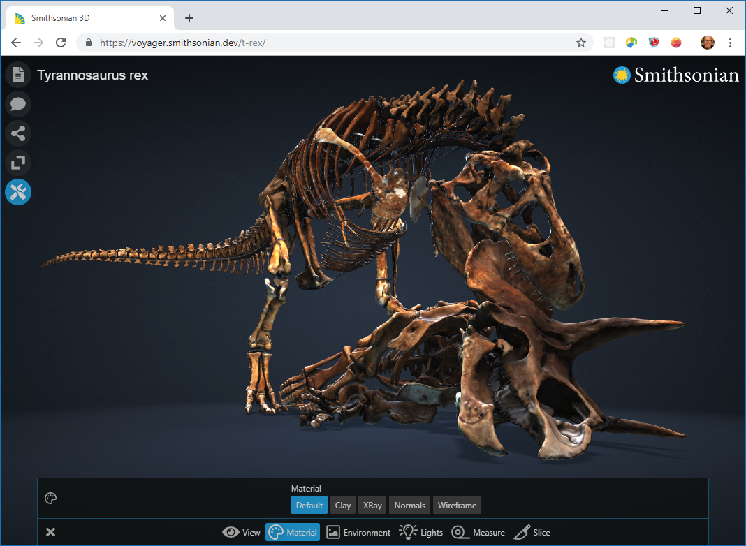
The project is an interdisciplinary collaboration on developing and deploying a 3D viewer for education and research purposes. This project, which we called 3D WorkSpace, is a collaboration with Loes Opgenhaffen, PhD researcher in the TPW project, Hugo Huurdeman, freelance designer (Timeless Future), Leon van Wissen, scientific programmer of CREATE, and is being executed in cooperation with Paul Melis and Casper van Leeuwen from SURF and the developers of the Smithsonian Institute represented by Jamie Cope, computer engineer at the Digitization Program Office of the Smithsonian Institute. Here, we present an outline of the project that will start in March, 2022.

Open access 3D models are often placed in online platforms with limited options for interactive communication and education. Although some 3D collections are published with their associated metadata, paradata, annotations and interpretations, these currently provide no open tools for re-use or interactivity. The Voyager digital museum curation tool suite, developed by the Smithsonian Institute, allows for interactivity and enrichment of the data but does not enable reuse or open content creation in a multiuser environment. Annotating, adding information to a 3D model without modifying the model itself, is possible for the creators of the content, but not for the end-users.

3DWorkSpace will facilitate re-use of 3D models through the addition of annotations and narratives, as well as side-by-side comparison of multiple models, within an online app environment adapted from the open source Voyager platform. It will allow data enrichment by enabling multi-authoring through the built-in annotation system, as well as through linkage to datasets (e.g., thesauri and museum catalogues) available as Linked Open Data (LOD). Two heritage-based case studies, production traces on experimental ceramics from the Tracing the Potter’s Wheel and a drone-based dataset from the 4D Research Lab, will allow full exploration of diverse 3D models for the implementation and testing of the adapted Voyager environment. Learning pathways, using the Voyager annotation feature, will train users in the necessary skills for guiding analysis of the 3D data models.

3DWorkSpace utilizes existing open access resources to realise a truly open science platform: from adaptation of the Voyager tool suite and testing with web-based open access 3D datasets, to technical support for data creation and access via Linked Open Data and Figshare. Evaluation will occur in tandem with the creation of training materials for technical set-up and 3D data curation. In this way we will lower the threshold for adoption, create best practice through training and demonstration, and create a roadmap for implementation and evaluation.

Although born from the material culture field, 3DWorkSpace is an initiative aimed at any field engaging with 3D data visualisation, as well as users seeking to integrate interactivity and data re-use, and will open up new ways of communicating and debating the narratives in which 3D reconstructions function for educators, researchers, students and general users.

We are really looking forward starting with this project!

Screenshot of the Voyager app

Virtual Past Places, a collaborative VR for storytelling and education

With this blog post, we would like to introduce our online virtual reality platform Virtual Past Places. From early 2021 the 4DRL has started experimenting with the browser-based collaborative VR technology of Mozilla Hubs. This came as a natural follow-up from the experiments with various Blended Learning projects in ACASA and the current interest of the 4D Research Lab into extended reality applications for storytelling and educational purposes (see e.g. here and here). Initially, the 4DRL was contacted by Paul Melis and Caspar van Leeuwen at SURF (find them here) to provide a case study for a pilot with the XR ERA network, Centre for Innovation, Leiden University, which we picked up on. The experience generated a lot of enthusiasm and ideas to continue to explore the possibilities in the 4DRL field of expertise: material heritage studies in a broad sense. This is evidently very relevant in times of Covid that placed emphasis on the necessity of online and hybrid learning approaches. This blog post aims to provide a succinct overview of recent developments and plans for the immediate future, and stages the Virtual Past Places website.

Homepage of Virtual Past Places

Experiencing virtual Vlooienburg

For the initial experiment with the XR ERA network, we used (part of) the historical reconstructions of the Vlooienburg neighbourhood, which provided us with a first impression. In addition a second room, a virtual exhibition space, was created to introduce the research project and elucidate the reconstruction process while allowing participants getting acquainted with navigating the environment. The experiences have been written up here and here, where the proper credits for this collaboration can also be found. Some of the more interesting positive observations were on 1) the possibilities presented by the platform to create different VR settings, 2) a straightforward sense of being which was much more pronounced than with a regular slideshow, 3) the fact that the onboarding was not too hard, at least not for the tech-savvy group of participants of that meeting and 4) a general sense of enthusiasm about the potential to experience 3D content in a first-person life sized perspective.

After the initial experience with the XR ERA network group, the excursion was repeated in various settings, ranging from research meetings to social events, and even valorisation purposes, the contents of the tour expanding every time.

Screenshot of the Vlooienburg VR experiment with XR ERA and SURF

Expanding the range of VR places

Inspired by these possibilities, funds have been obtained to create other virtual experiences as well. Where the Vlooienburg reconstructions represent a lost neighbourhood and how that could have looked like, as a set of visualised historical hypotheses, we thought it would be nice to add other types of projects that can benefit from virtualization.

For example, for the iconic UNESCO world heritage site of Troy, Turkey, we used models derived through drone and terrestrial photogrammetry to create a digital twin of the archaeological remains. ACASA is currently executing the Archaeology of Archaeology project at this renowned site. Although Troy is physically accessible, it is at the same time a far-away site, where you cannot take students at any moment it is opportune for a teaching module. Furthermore, it is often flooded by tourists affecting the experience, and moreover fenced off so there are parts of the site actually inaccessible for all but the archaeologists themselves. In close collaboration with project director dr. Gert Jan van Wijngaarden, a virtual tour was created, focusing on the Archaeology of Archaeology project with a specific attention on the ‘silent’ unknown workmen that did the actual excavation in most periods. Virtual information panels were placed at the site that served as illustrative materials alongside the site and the excavation trenches themselves.

Another interesting option is to place a real excavation in VR space as well. Usually such archaeological material remains are only visible during the excavation, where in the rest of the year they lie under a protective cover. The VR could allow for presenting the excavated remains and discuss the complex interpretations of the archaeology present to students and colleagues. They can enter the actual trenches where they would physically not be allowed to do so. An environment such as this can serve interesting purposes in student preparations for coming fieldwork campaigns, as well as to teach them about basic archaeological excavation methods.

Grassroots innovation

All in all, these endeavors gave us a lot of hands-on problem solving experiences with the software, which has been very helpful in getting things to run smoothly for the various VR spaces. In addition, and most importantly, the ongoing experimentation and evaluation allows for a build-up of experience and ideas on how to use such a collaborative VR effectively for storytelling and teaching purposes. Currently, this has culminated in a UvA innovation (Grassroots) project, in which we will implement Mozilla Hubs experiences as class modules in close collaboration with Gert Jan van Wijngaarden and other teachers at ACASA.

Examples of these are courses such as Archaeology, Museums and the Public, where the experience of authenticity will be critically assessed for the virtual environments, or the Research lab: The palaces of Troy IV, where the Troy VR will provide students with a comprehensible and detailed visualisation of the study subject.

The subsidy allowed the installation of a Mozilla Hubs cloud for ACASA, that provides three key-advantages; 1) control over content, as we retain full ownership over the uploaded materials, which is an important aspect in the world of heritage and visual rights, 2) scalability, i.e. temporarily upscale server capacity to allow much more participants then the standard number, and 3) branding and creating a UvA landing page, so we have been able to develop an easily accessible visual portal into the virtual spaces, which became Virtual Past Places. Furthermore, the subsidy will provide for technical assistance necessary for the cloud implementation and application during classes.

Towards further integration

At the moment, opportunities for further research and implementation are being explored. Since the content and infrastructure are secured, we aim for a deepening the conceptual embedding of VR spaces in the teaching modules, and combine that with a thorough evaluation programme to gather empirical data on the advantages and disadvantages of this technology in an educational context.

In the meantime, we welcome you at the Virtual Past Places website, where all discussed VRs (and more) are accessible: https://www.virtualpastplaces.eu/

Screenshot of Satricum VR, excavation of a Roman villa

Principles and standards

We finally got around writing up the 4D Research Lab approach on 3D visualisation. For the use of virtual reconstruction in the context of academic research, it is paramount to have a clear conception on both the modeling process as well as the final result, and communicate this as well as possible. Thorough research, responsibility, transparency and verification are key-concepts here. For the 4D Research Lab principles and standards, this amounts to:

  • A principle statement, in which we define the role of 3D visualisation in academia, our views on academic rigour, accessibility and sustainability. As for academic rigour, we build forth on “The London Charter for the computer-based visualization of cultural heritage” and the “Principles of Seville, international principles of virtual archaeology”.
  • A template, which is the application of the principle statement into a standard format for execution and documentation of 3D visualisation projects, and compiling reports.
  • A definition of our take on dealing with (un)certainty in 3D visualisation, accompanied with a 6 degree classification of certainty levels.

These standards and principles will be applied to all projects of the 4D Research Lab to ensure uniformity but also to create a database to be able to compare their performance. Surely, in due course we will find that we might improve on our project template or classification of (un)certainty. We do not consider them written in stone, but as a culmination of our experience so far, and they will surely be susceptible to future evolution into better versions of themselves.

Certainty Class

Variability

Indication


Example

Colour

Certain

None

Empirical

Scanned remains

89a5c1

Quite certain

Low

Logical extension

Missing part of relatively complete
object

95bf8f

Moderately certain

Limited

Close parallel

Same type, direct relation

eee3ab

Not so certain

Considerable

General parallel

Same type, indirect relation

d9cfc1

Quite uncertain

High

Historic context

General stylistic traditions

a77e58

Very uncertain

Very high

Theoretical

Constructional argument

ba3f1d

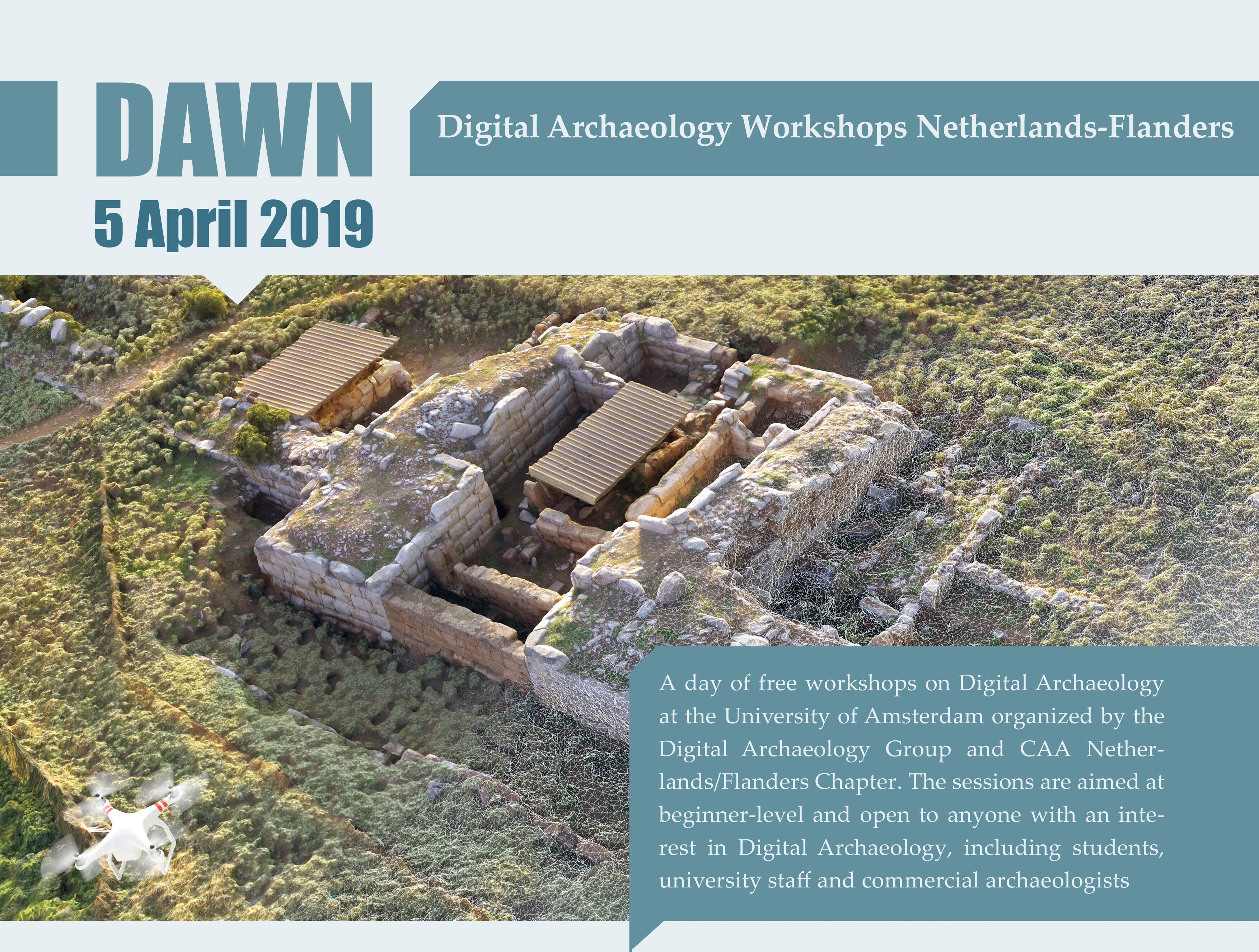
Digital Archaeology Workshop 2019 – registration open!

Always wanted to learn digital archaeology skills but never got to? This is your chance! Did I hear GIS? Check! 3D modelling in Blender? Check! Programming in R? Check! Photoscanning? Check!

At the 5th of April we’ll be taking part in the DAWN 2019. The workshop is a yearly recurring event organized by the DAG and CAA Netherlands Flanders. This year it is hosted by the University of Amsterdam and ACASA.

Aimed at beginner level.

Sign up NOW!

Co-hosted and organized by the 4D Research Lab.